GEOMOCKERY
Generate synthetic geospatial datasets for demos, testing, and development. No server, no account, no waiting.
Early v0.1 — core workflow is usable. Some edges are still being tightened.
What Geomockery does
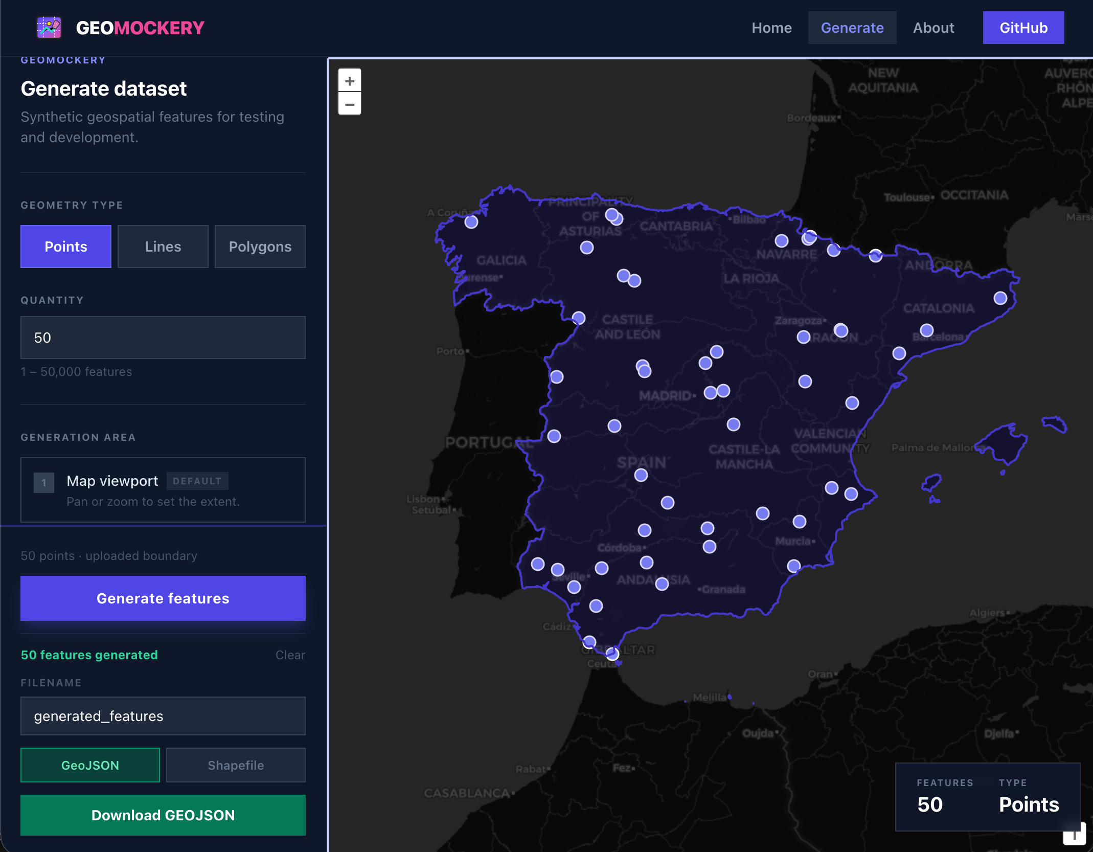
Points, Lines & Polygons
Generate any geometry type inside a drawn boundary, uploaded GeoJSON, or the current map viewport.
Custom attribute schemas
Define nominal, ordinal, quantitative, temporal, and identifier attributes. Values are generated automatically.
GeoJSON & Shapefile export
Download your dataset immediately. Runs entirely in the browser — no server, no account required.
Draw or upload boundaries
Sketch a polygon directly on the map, or upload a GeoJSON file to constrain generation to any area.
Live map preview
Generated features appear on an interactive OpenLayers map immediately — inspect before you export.
Prompt-assisted setup
Describe your dataset in plain text and let built-in keyword matching prefill geometry type, quantity, and attributes. No LLM — this is a basic helper still in development.
Stop waiting for real data
Geospatial developers constantly need data that is unavailable, restricted, or just too slow to obtain. Geomockery fills that gap.
The problem
- Real data isn't ready — and never will be on your timeline
- Production data is off-limits for privacy or legal reasons
- You need specific edge cases that don't naturally exist
- Client data is under NDA but you still need to build
Geomockery
- Generate synthetic data in seconds, not weeks
- Fully configurable geometry type, count, and attributes
- Runs in the browser — no server, no API key
- Export immediately as GeoJSON or Shapefile
Ready to generate?
Create synthetic geospatial features with configurable attributes in seconds.
Open the generator